


Avenza Maps: Offline Mapping
4.510.48K Reviews
App Specs
- Version
- 5.7
- Updated On
- License
- Free
- Downloads
- 5,000,000+
- Developer
- Avenza Systems Inc.
- Categories
- Maps & Navigation
- Platform
- Android, iOS
Screenshots
 Analysis by AppCompare
Ever found yourself in the middle of nowhere, desperately trying to get your bearings without a hint of Wi-Fi? Yup, been there, done that. Enter Avenza Maps, your new best friend for all things offline mapping. Whether you're a hiker, biker, or just someone who enjoys the peace and quiet of the great outdoors, this app is a total game-changer.
Free to start, with purchases to consider
Avenza Maps is a free navigation app from Avenza Systems Inc., and that makes it easy to try before deciding whether it fits your routine. It also offers in-app purchases, with items ranging from $0.99 to $249.99. That broad range is worth keeping in mind: free access does not mean every map or option you might want is free, so I’d check the cost of a specific item before planning around it. I wouldn’t assume a purchase is necessary for every user, either; the practical value depends on the maps you choose and the way you use the app.
Its 4.7 average from around 105,000 ratings, along with over 5 million installs, suggests that many people have found a reason to keep it on their phones. It’s rated for Everyone, and version 5.5 requires operating system 10 or later. I’d treat those details as a quick compatibility check, not a guarantee that every device will feel equally convenient: map browsing and reading are easier on a screen that suits the size and detail of the maps you use.
Get Ready to Navigate: The Basics
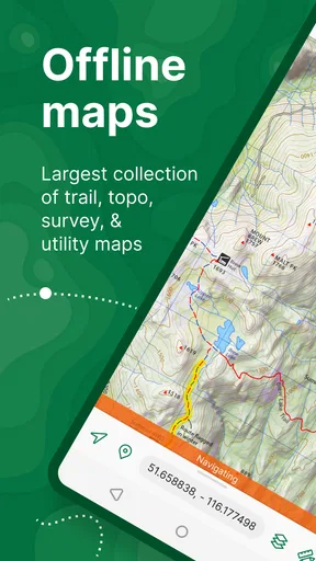
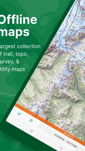
So, what’s the deal with Avenza Maps? At its core, this app is all about giving you access to a massive library of maps that you can use offline. Yes, you heard that right—offline. No more getting lost because you wandered out of cell service range. With over a million maps available, you’re pretty much covered wherever you go. Think topographic maps, park maps, and even specialized maps for specific activities like hiking or biking.
Map Library Galore
The app's map store is like a candy shop for map enthusiasts. You can browse through a vast collection, which includes maps from National Geographic, USGS, and many other reputable sources. The best part? You can download these maps to your device and access them without needing any internet connection. It's pretty slick, especially when you’re off the grid.
Making a map useful before you leave
The part I’d build into my routine is preparation at home: find the map that matches the area and activity, download it while connected, then open it once before setting out. That last check is easy to skip, but it helps make sure the map is actually in your library and that you know how to find it again. A saved map is most useful when it is ready before the signal disappears, rather than something you try to search for at a trailhead with patchy reception.
Map choice matters as much as having a map at all. A broad regional sheet can be useful for seeing how an outing fits into the surrounding area, while a detailed local map is better for checking turns or landmarks. If you are choosing between several options, look at the map itself and its intended use rather than downloading the first result. The app’s offline access is a real advantage, but it cannot make a map more detailed or suitable than the one you selected.
Worth Reading Before You Choose

Flipboard Shows What News Apps Must Do Beyond the Feed

Switching to Android Auto Means Rethinking Your Driving Routine

Google Calendar Makes a Crowded Week Easier to Manage

Ludo King Makes the Most of the Minutes Between Plans

Baby Panda World Brings Quick Play to Modern Phones, but Its Game Library Feels Busy

ESPN’s Live Game View Makes Following Close Games Easier
Features You’ll Love
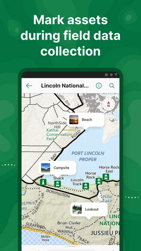
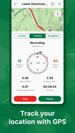
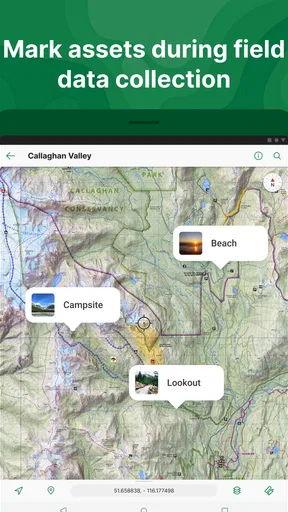
Beyond just maps, Avenza Maps offers some seriously cool features. One of my favorites is the ability to add placemarks, which lets you drop pins on your map to mark important spots. You can also record GPS tracks, so you can see where you've been and how far you've traveled. It’s like having a breadcrumb trail to follow back home.
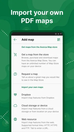
The app also lets you measure distances and areas, which is super handy if you’re planning a route or just want to know how far that epic hike is going to be. Plus, you can import your own custom maps if you’ve got something specific in mind. The customization options make it incredibly versatile.
Small tools that improve a trip
Placemarks become more useful when I give them a clear purpose before a trip. I might mark a parking area, a trail junction I do not want to miss, or a meeting point for a group. That makes the map more than a screen to glance at: it becomes a set of personal reminders tied to places. I’d still avoid relying on a pin as the only record of an important plan; a written note or a companion’s understanding is a sensible backup.
Track recording and distance measurement answer different questions. A track can help me review where I actually walked, while measuring on a map can help me estimate a route before I go. Neither should be treated as a promise about how long a trip will take: terrain, stops, and route choices all change the experience. For land or area work, measurements are useful for a quick reference, but anyone making a consequential surveying decision should use an appropriate professional workflow rather than treating a phone map as a substitute for it.
Usability and Interface
Now, let's talk about the user experience. The interface is intuitive and user-friendly. Even if you’re not a tech wizard, you’ll find it easy to navigate. The app is designed to make map browsing and downloading a breeze. Just a few taps, and you’re ready to roll.
The search function in the map store is also pretty robust, allowing you to find maps by keywords, location, or even the publisher's name. Once you’ve downloaded a map, you can access it quickly from your library, making the whole process of switching between maps seamless.
What it feels like in ordinary use
Picture a weekend walk in a place where mobile coverage comes and goes. I would search for a suitable map before leaving, save it, and check that I can open it. On the day, the GPS position can help me relate my location to the map even when data service is unavailable. If the route changes, I can use the map to orient myself, leave a placemark at a useful junction, and record the path I took. That is a practical workflow, not a replacement for paying attention to signs, terrain, and the people I am travelling with.
For a regular city commute, I would usually reach first for a familiar street-navigation app. Those tools are generally built around live directions and current road conditions, while Avenza’s appeal is having a chosen map available offline and working with its map-specific tools. For an outdoor trip, a trail or topographic map may show the context I want in a way that a turn-by-turn route does not. I see the apps as serving different jobs, rather than expecting one to replace every other map on my phone.
Offline Navigation at Its Best
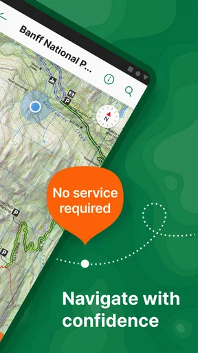
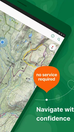
One of the standout features of Avenza Maps is its offline navigation capability. When you’re out in the wilderness, the app uses your device’s built-in GPS to show your location on the map in real-time. No internet? No problem. It’s like having a trusty guide in your pocket, ready to help you navigate through any landscape.
What offline use can and cannot do
Offline access is most reassuring when it is planned rather than improvised. Downloading maps beforehand means you are not depending on a signal to retrieve them once you are away from service. The phone still needs to be usable and able to determine its position, and the map needs to cover the ground you are actually visiting. I would not treat an offline map as a rescue service or assume that GPS positioning removes the need for basic preparation, a charged device, and sound judgement.
One useful habit is to check the map’s boundaries against the whole outing, including the start, destination, and any likely detours. It is easy to choose a map that includes the main trail but not the access road or the area where you plan to park. If you import a custom map, it is especially important to confirm that it displays in the intended location and at a useful level of detail before relying on it outdoors.
Who will get the most from it
I’d recommend it most to hikers, cyclists, field workers, and map-minded travellers who already know the value of a particular paper-style or specialist map and want to carry it digitally. The placemarks, track recording, and measuring tools give those users a reason to open the app beyond simply checking their position. It can also suit someone who visits the same outdoor area more than once and wants to keep a downloaded map ready for the next trip.
On the other hand, I would not choose it as my only navigation tool if what I mainly want is automatic driving directions, live traffic, or a simple route from one street address to another. Someone who dislikes preparing maps in advance may also prefer a service that centres on online search and turn-by-turn guidance. The choice is less about which app is universally better and more about whether you want to work from a selected map or have an app generate directions for you.
Why You’ll Want It
If you’re someone who loves the outdoors, this app is a must-have. It’s perfect for those spontaneous adventures when you decide to go off the beaten path. Not only does it enhance your outdoor experiences, but it also adds a layer of safety by ensuring you always know where you are.
Ultimately, Avenza Maps offers peace of mind. It’s a reliable tool that won't let you down when you most need it. Whether you're tackling rugged terrain or simply exploring a new city, this app has got your back.
My buy-or-skip take
My view is that the free starting point makes it reasonable to explore the app, especially if offline maps and map-based tools address a real need for you. Before spending anything, I’d identify the map I actually want and check its price in the app, since purchases vary widely. That makes the value decision clearer than judging the app by the possibility of paid items alone: a map you will use repeatedly may be worthwhile, while buying maps for an occasional outing may not suit everyone.
It is a strong fit when I want a saved map, GPS position, and a few practical ways to annotate or review a trip. It is a weaker fit when I expect live road guidance to do the planning for me. That distinction is the main thing I’d want a friend to understand before downloading: Avenza Maps rewards a little preparation, and its value rises when the maps and tools match a real activity.
So, if you’re itching for your next adventure and want to make sure you’re well-prepared, give Avenza Maps a shot. It might just become your go-to app for all your mapping needs. Happy exploring!
Pros
- Offline maps for remote areas
- User-friendly interface
- Customizable map layers
- Import/export map data easily
- Accurate GPS tracking
Cons
- Limited free features
- In-app purchases can be pricey
- Occasional map loading delays
- No real-time traffic updates
- Requires significant storage space
FAQs for Avenza Maps: Offline Mapping
What is Avenza Maps and how does it work offline?
Avenza Maps is a mobile mapping app designed for offline use, allowing users to access maps without an internet connection. By downloading maps to your device in advance, you can navigate and view your location using GPS even in areas without network coverage. This feature is particularly useful for outdoor activities like hiking or traveling in remote regions.
Are there any costs associated with using Avenza Maps?
Avenza Maps offers a free version with basic features, but some maps and advanced functionalities may require in-app purchases. Users can buy individual maps from the Avenza Map Store or subscribe to monthly plans for additional benefits like unlimited map imports and access to premium maps. It’s advisable to review the pricing details in the app for clarity.
Can I import my own maps into Avenza Maps?
Yes, Avenza Maps allows users to import their own maps in formats such as GeoPDF and GeoTIFF. This feature is particularly beneficial for those who need customized maps for specific purposes. However, the number of imports may be limited in the free version, so users might need to upgrade to a paid plan for unlimited imports.
What kind of maps are available in the Avenza Map Store?
The Avenza Map Store provides a wide variety of maps, including topographic, nautical, and transit maps. Users can find maps suited for hiking, cycling, and other outdoor activities as well as urban navigation. The store features contributions from renowned publishers and government agencies, ensuring accuracy and reliability.
Is Avenza Maps suitable for professional use?
Avenza Maps is ideal for both recreational and professional use. Professionals in fields like forestry, emergency response, and land management often utilize its capabilities for fieldwork. The app supports georeferencing and data collection, making it a valuable tool for tasks requiring precise location tracking and map-based analysis.


